Quick Facts
- Total Distance: Approximately 72 miles point-to-point.
- Elevation Profile: Roughly 15,500 feet of total elevation gain.
- Optimal Window: Late July through September for snow-free passes.
- Permit Requirement: Specific High Sierra Trail wilderness permit required (Quota Season).
- Typical Duration: 6 to 8 days depending on pace and acclimatization.
- Maximum Altitude: 14,505 feet at the summit of Mount Whitney.
- Food Storage: Hard-sided bear canisters are mandatory for most sections.
The High Sierra Trail is a premier 72-mile thru-hike spanning from Crescent Meadow in Sequoia National Park to the summit of Mount Whitney. This strenuous west-to-east trek across the Great Western Divide requires a specific wilderness permit and typically takes 6-8 days to complete. Whether you are navigating the granite catwalks of the Hamilton Gorge or soaking in the Kern Hot Springs, this route offers the most diverse trans-Sierra experience available to backpackers today.
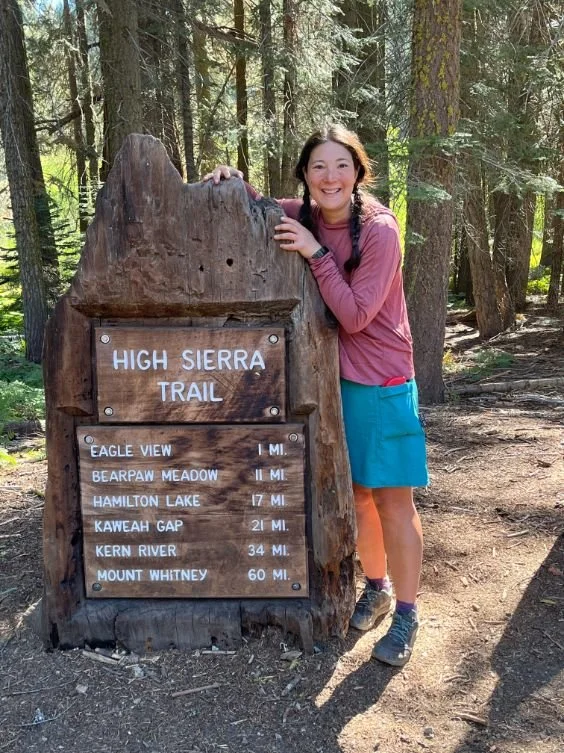
High Sierra Trail Permit Guide: Strategy & Dates
Securing a permit for the High Sierra Trail is the first major hurdle of the journey. Unlike the John Muir Trail, which uses a rolling lottery, the Sequoia to Mount Whitney thru-hike follows a more structured window. All permits are managed via Recreation.gov under the Sequoia and Kings Canyon National Parks Wilderness Permits section.
The High Sierra Trail permit lottery strategy begins in mid-winter. The primary lottery applications are accepted from February 1 through March 1 each year. During this window, you can list multiple start dates and group sizes. If you miss the lottery, remaining permits are released on April 22 at 7:00 AM PT. These often disappear within seconds, so having a fast internet connection and a pre-logged-in account is essential.
The quota season runs from late May to late September. If you plan to hike outside these dates, permits are free and self-issued at ranger stations, though you must still follow all wilderness regulations. For those who strike out online, a limited number of walk-up permits are available at the Lodgepole Village Wilderness Office starting at 1:00 PM the day before your intended start. However, relying on walk-ups for a group larger than two is risky. Remember that the specific High Sierra Trail wilderness permit is mandatory for any travel between Seven Mile Hill and Kaweah Gap.
Transportation: Shuttle Logistics Sequoia to Whitney Portal
The biggest logistical headache of backpacking Sequoia National Park to Mt Whitney is the fact that the start and end points are roughly a six-hour drive apart. Because the trail is a point-to-point trek ending at the Whitney Portal terminus, you cannot simply loop back to your car.
Most hikers choose one of three strategies to manage the gap between Crescent Meadow and Lone Pine. A two-car shuttle is the most cost-effective but requires a full day of driving (12 hours round-trip) to position vehicles. Alternatively, you can park your car at the Lone Pine Chamber of Commerce for a small fee of about $25 per week and utilize public transit. This involves taking the Eastern Sierra Transit bus from Lone Pine to Lancaster or Mojave, then connecting to Visalia, and finally catching the Sequoia Shuttle into the park. This usually requires an overnight stay in Visalia.
For those with a larger budget, private shuttle services are available. These services can cost between $800 and $1,300 per group, but they offer the convenience of a direct transfer from the Whitney Portal terminus back to Sequoia National Park.
| Option | Estimated Cost | Total Travel Time | Best For |
|---|---|---|---|
| Private Shuttle | $800+ per group | 6 hours | Large groups, time-sensitive hikers |
| Public Transit | $60 - $100 per person | 1.5 days | Solo hikers, budget travelers |
| Two-Car Shuttle | Fuel costs only | 12 hours (driving) | Local hikers with two vehicles |
Pro-Tip: If you park at Whitney Portal, ensure all food and scented items are removed from your vehicle. The local bear population is notorious for breaking into cars that smell like a snack.
7-Day High Sierra Trail Itinerary: From Redwoods to High Peaks
The High Sierra Trail is best experienced when you break it into three distinct phases: the ascent to the Great Western Divide, the descent into the Kern River Canyon, and the final climb to the Sierra Crest. A 7 day High Sierra Trail itinerary allows for sufficient altitude acclimatization while keeping the daily mileage manageable.
Phase 1: The Great Western Divide (Days 1-3)
Your journey begins at the Crescent Meadow trailhead, winding through massive Sequoia groves before the terrain shifts to rugged granite. The first few days are characterized by steady climbing and jaw-dropping views of the sub-alpine landscape.
- Day 1: Crescent Meadow to Bearpaw Meadow (11.5 miles) – A moderate start through lush forests. Bearpaw Meadow offers a stable water source and a historic High Sierra camp.
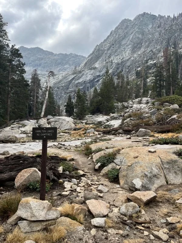
- Day 2: Bearpaw Meadow to Hamilton Lakes (4 miles) – A shorter day to allow for rest before the big climb. The view of Valhalla and the surrounding granite monoliths is legendary.
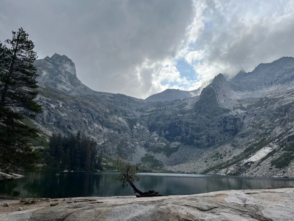
Phase 2: The Kern River Canyon (Days 3-5)
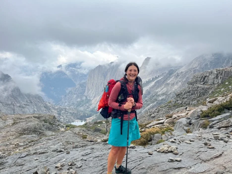
Crossing Kaweah Gap is a literal and figurative high point. Once over the pass, you leave the western slope behind and enter the remote Sierra Nevada backcountry.
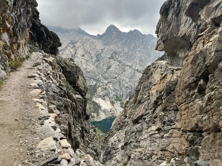
- Day 3: Hamilton Lakes to Big Arroyo (7 miles) – You will pass through the Hamilton Gorge via impressive trail engineering catwalks. After a lunch at Precipice Lake, you will cross Kaweah Gap and descend into the Big Arroyo.
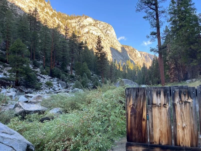
- Day 4: Big Arroyo to Kern Hot Springs (13 miles) – A long descent brings you to the bottom of the Kern Canyon. The Kern Hot Springs backpacking guide highlight is, of course, the natural hot tub located right next to the river. It is the perfect place to soothe sore muscles.
Phase 3: The High Sierra Crest (Days 5-7)
The final phase involves a massive climb out of the canyon toward the base of Mount Whitney. This is where the High Sierra Trail vs John Muir Trail comparison becomes most evident, as the HST approaches the summit from the west, offering a quieter, more solitary experience than the often-crowded JMT route.
- Day 5: Kern Hot Springs to Junction Meadow (8 miles) – A steady, gradual climb up the canyon. Keep an eye out for High Sierra Trail campsites with bear boxes to make your evening chores easier.
- Day 6: Junction Meadow to Guitar Lake (11 miles) – A strenuous climb takes you above the tree line. Guitar Lake serves as the final staging area for the summit push.
- Day 7: Guitar Lake to Whitney Portal (15 miles) – The ultimate challenge. You will summit the highest peak in the lower 48 before descending the 99 switchbacks.
Summiting Mount Whitney: The Final Push
The final push for the summit of Mount Whitney is both a physical and mental test. Most hikers leave Guitar Lake before dawn to reach the peak for sunrise or to avoid afternoon thunderstorms. The trek reaches its highest point at the summit of Mount Whitney, which stands at an elevation of 14,505 feet and is the tallest peak in the contiguous United States.
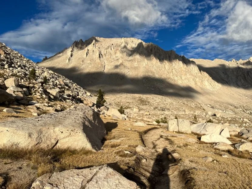
One critical aspect of High Sierra Trail water sources and resupply tips is the final water fill-up. The last reliable water source before the summit is at roughly 12,400 feet, just above Guitar Lake. You will need to carry enough water to sustain you through the summit and the long descent to Trail Camp on the eastern side.
As you navigate the trail engineering catwalks on the way to Trail Crest, the scale of the granite monoliths becomes overwhelming. Proper altitude acclimatization is your best defense against mountain sickness here. If you start feeling dizzy or nauseous, it is vital to descend immediately rather than pushing for the summit.
Essential Gear & Regulations
Protecting the Sierra Nevada backcountry is a shared responsibility. Because this route passes through multiple wilderness jurisdictions, specific regulations apply regarding waste and food storage.
Backpackers on the High Sierra Trail typically experience a total elevation gain of roughly 15,000 feet and usually complete the route within 6 to 8 days. This much climbing requires a lightweight but robust gear setup.
- Food Storage: Backpacking High Sierra Trail bear canister requirements are strictly enforced. You must use an approved hard-sided container (like a BearVault or Wild Ideas Bearikade). While there are some High Sierra Trail campsites with bear boxes, they are not present at every location, and a canister is mandatory for the Whitney zone.
- Human Waste: Once you leave the Kern Canyon and approach the Whitney zone, you are required to use "wag bags" to pack out all human waste. These are often provided at the ranger station or the Whitney Portal terminus, but it is best to carry your own.
- Navigation: Even with a clear path, a GPS device with a 2026 GPX track is recommended for navigating snow-covered passes in early summer.
FAQ
How long is the High Sierra Trail?
The High Sierra Trail spans approximately 72 miles from its start at Crescent Meadow in Sequoia National Park to its conclusion at the Whitney Portal trailhead.
How do I get a permit for the High Sierra Trail?
Permits are obtained through a lottery on Recreation.gov between February 1 and March 1. Remaining permits are released on April 22. You must select the specific High Sierra Trail starting from Crescent Meadow.
Where does the High Sierra Trail start and end?
The trail starts at the Crescent Meadow trailhead in the Giant Forest area of Sequoia National Park and ends at Whitney Portal, just west of Lone Pine, California.
How many days does it take to hike the High Sierra Trail?
Most backpackers take 6 to 8 days. Stronger hikers may finish in 5 days, while those who want to enjoy the Kern Hot Springs or fish at Hamilton Lakes often prefer 9 or 10 days.
Do you need a bear canister for the High Sierra Trail?
Yes, a hard-sided bear canister is required. Even though some lower-elevation camps have bear boxes, you will visit areas (like Guitar Lake and the Whitney Zone) where canisters are the only legal way to store food and scented items.
How do I get back from Whitney Portal to Crescent Meadow?
The most common methods are a two-car shuttle, a private shuttle service (costing $800+), or a multi-leg public transit journey involving the Eastern Sierra Transit bus and the Sequoia Shuttle via Visalia.